
Portland's Waterfront Evolution: From Industrial Past to Vibrant Public Spaces and What's Next
From Docks and Warehouses to Parks and Promenades
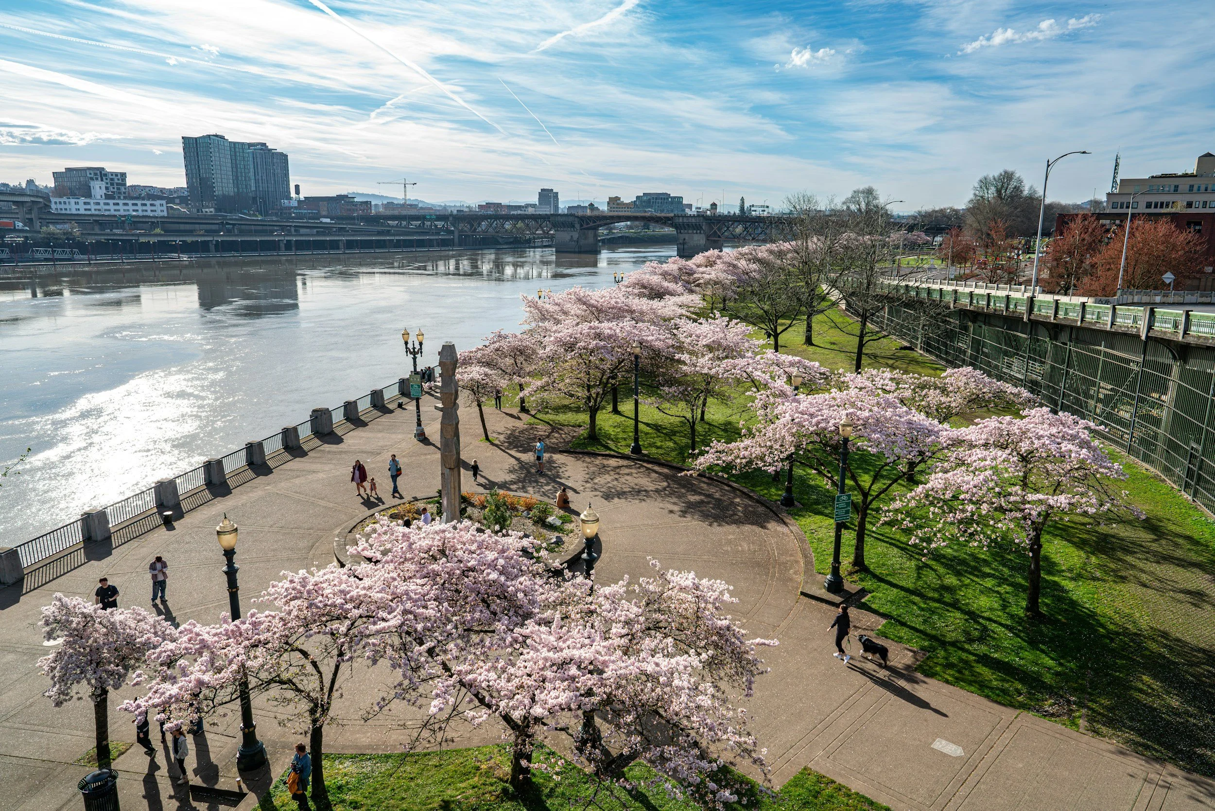
Walk along Portland's waterfront today, and it's hard to imagine that just a few decades ago, this stretch of the Willamette was dominated by highways, industrial warehouses, and working docks. The transformation didn't happen overnight—it took vision, community pushback, and a willingness to rethink what a river could mean to a city. In the 1970s, Portland made a bold move by tearing down the Harbor Drive freeway and replacing it with what would become Tom McCall Waterfront Park. That decision set the tone for everything that followed: prioritizing people and public access over cars and commerce. Today, the 1.5-mile park is a living testament to that shift, hosting everything from Saturday Market to summer concerts, while joggers, cyclists, and families claim the space daily.
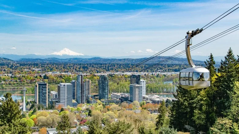
But the story doesn't stop at Waterfront Park. Over the past two decades, Portland has continued to reclaim its riverfront, piece by piece. The South Waterfront district—once a post-industrial no-man's-land—has evolved into a mixed-use neighborhood with high-rises, green spaces, and the Portland Aerial Tram connecting residents to OHSU on the hill above.
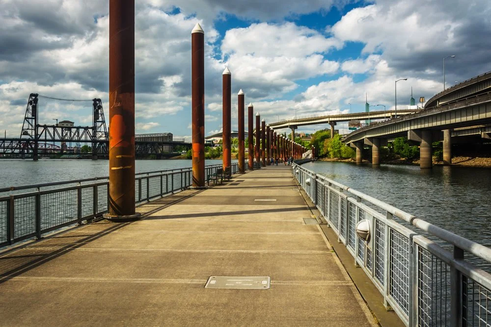
The Eastbank Esplanade, completed in 2001, gave the east side of the river its own multi-use path, complete with a floating walkway that rises and falls with the river's seasonal changes. These spaces aren't just pretty additions to the city—they're functional, connecting neighborhoods, providing transportation alternatives, and creating gathering spots that feel authentically Portland.
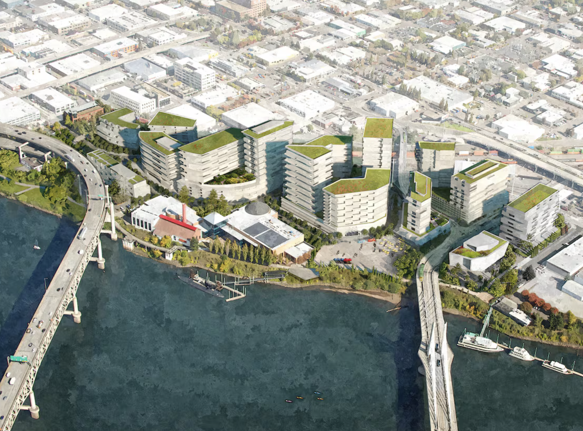
The City of Portland Design Commission has approved the OMSI District Master Plan, setting the stage for a major transformation of a 10-block area in the Central Eastside around the Oregon Museum of Science and Industry. The plan centers on creating a waterfront education park along the Willamette River, expanding public green space, and adding more than a thousand housing units to build a mixed-use neighborhood anchored by science learning, arts and culture.
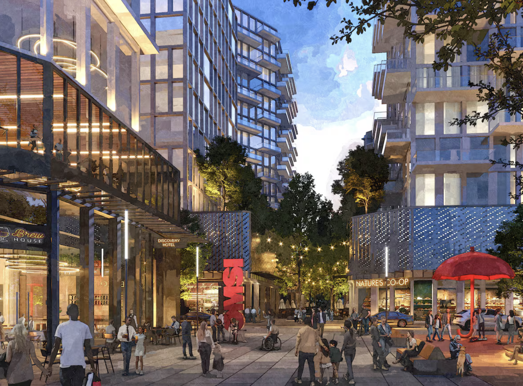
OMSI’s CEO and president, Erin Graham, says the redesigned district—still years from completion—will offer outdoor play and discovery for all ages, with surprising, delightful features that draw people back. The plan emphasizes stronger connections to the river so visitors feel welcome, develop an affinity for the river, and gain a better understanding of efforts to restore its health.
The master plan aligns with the City’s broader River Plan goals to balance industrial activity with natural-area restoration and improved public access, signaling ongoing work to make Portland’s riverfront more accessible and ecologically vibrant.Along the lower Willamette, efforts are underway to restore habitat for salmon and other native species, while also addressing legacy pollution from the area's industrial past. Meanwhile, neighborhoods like St. Johns are exploring how to better connect their communities to the river, with proposed trails and parks that would open up previously inaccessible stretches of shoreline.
The Bowl Gets a Bold Redesign
The waterfront's evolution is about to take another major leap forward. Oregon Metro recently awarded Portland Parks & Recreation a $750,000 Planning and Development Grant to reimagine the Tom McCall Waterfront Park Bowl—that underutilized stretch between RiverPlace and the Marina, just south of the Hawthorne Bridge. The funding, drawn from Metro's construction excise tax, will launch a two-and-a-half-year design competition inviting consultants to dream up a new vision for the space. The goal? Transform the Bowl into a world-class amphitheater and river park that offers both premier event space and genuine "toes in the water" access to the Willamette. Think outdoor stages for concerts and cultural gatherings, a reimagined river beach and shoreline, and designs that prioritize sustainability and ADA accessibility. It's a partnership effort between the city, Portland Waterfront Pavilion, and the Human Access Project—all working to create a space that feels as iconic as it is inviting, connecting downtown Portland to its river in ways that honor both the city's past and its future.
Looking ahead, Portland's waterfront will likely continue to reflect the city's values: sustainability, community access, and a respect for the natural environment. Proposed developments in areas like the Central Eastside and Northwest Industrial District are wrestling with how to preserve working waterfronts while also creating spaces for people to enjoy the river. It's a balancing act, but if Portland's past is any indication, the city will keep pushing for solutions that honor both its industrial heritage and its commitment to livable, human-centered spaces. Whether you're biking the Esplanade at sunset, catching a food cart lunch at Waterfront Park, or exploring the newer trails popping up along the river's edge, you're experiencing the ongoing story of a city that chose its river over its highway—and hasn't looked back.